
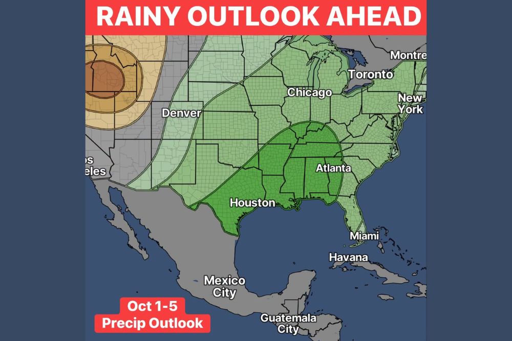
HOUSTON, TX — The first five days of October are shaping up wet for a large part of the United States. The latest October 1–5 precipitation outlook favors above-normal rain across much of the eastern two-thirds of the country, and the strongest signal sits over the Deep South. Texas, Louisiana, Mississippi, Alabama, Georgia and Tennessee fall inside the outlook’s core zone. That means the region could see several rounds of soaking rain as the new month begins, not just a single passing shower.
The Deep South Holds the Strongest Wet Signal
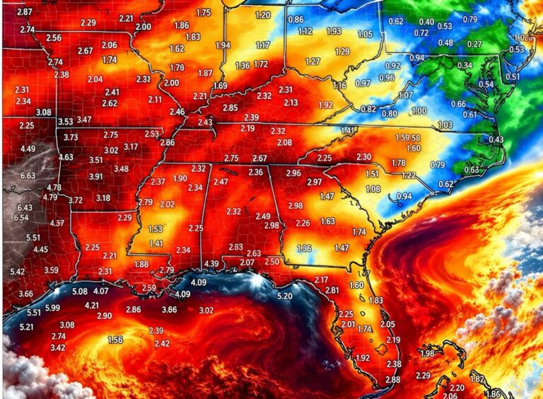
The heaviest shading on the outlook covers a wide corridor from eastern Texas, including Houston, northeast through Louisiana, Mississippi, Alabama and Georgia, including Atlanta. It then reaches into Tennessee, southern Kentucky and the Florida Panhandle. This zone has the highest odds of wetter-than-normal conditions during the October 1–5 window.
For people across the Gulf Coast and the Southeast, that could mean repeated rainy days, wet commutes and soggy weekend plans. Places that have been dry lately may welcome the rain. Areas that flood easily, especially in low-lying parts of Louisiana and southeast Texas, will want to watch local forecasts closely.
Wet Pattern Stretches From the Plains to the Northeast
The wet signal isn’t limited to the South. A broader zone of above-normal rain chances runs across the Central and Southern Plains, including much of Oklahoma, Kansas and Nebraska. It continues into the Midwest, covering Missouri, Iowa, Illinois including Chicago, Indiana, Ohio and Michigan.
That same pattern extends east through Pennsylvania, New York, including New York City, and much of New England, and south along the Mid-Atlantic and Carolinas. The Florida Peninsula, including Miami, also falls within the wetter-than-normal area. These regions carry a lower wet signal than the Deep South core, but they still lean toward a rainier stretch than usual for early October.
A lighter band of above-normal chances also reaches westward toward Colorado, including the Denver area, along with parts of New Mexico, Wyoming and Montana. That edges the wet pattern right up to the Rocky Mountain Front.
The West Leans Drier Than Normal
The picture flips completely in the western United States. The outlook shows a drier-than-normal signal centered over northern California, Nevada and southern Oregon, and the strongest dry odds sit over the northern Great Basin. Large parts of the Desert Southwest, including Arizona, Utah and southern California, fall into a near-normal zone with no strong lean either way.
That sharp split between a wet East and a dry West is a common early-autumn setup. It usually means the storm track is favoring the central and eastern states while the Pacific Coast and Great Basin stay under drier conditions.
What Residents Should Expect in Practical Terms
A precipitation outlook covers probabilities over a multi-day period. It doesn’t forecast rain for every hour or every town. Not every day between October 1 and October 5 will be rainy, and totals will vary a lot from place to place. Still, when an outlook shows this strong a signal across the South, it’s a good time to plan ahead for outdoor events, travel and yard work.
Farmers wrapping up the fall harvest across Texas, Mississippi, Alabama, Georgia and Tennessee may need to adjust field schedules. Drivers across the Interstate 10, Interstate 20 and Interstate 65 corridors should plan for slower travel if heavy rain develops. Homeowners can use the next few days to clear gutters and storm drains ahead of the wet stretch.
Outlook Details Could Shift in the Coming Days
Longer-range outlooks can change as the start date gets closer, so the exact placement of the heaviest rain may move over the coming days. Timing, rainfall totals and any possible flooding threat or thunderstorm risk will become clearer as short-range forecasts cover the October 1–5 period.
For now, the overall message is simple: October looks set to open on a wet note from the Gulf Coast to the Great Lakes and the Northeast, while the West stays mostly dry. Residents across Texas, Louisiana, Mississippi, Alabama, Georgia and Tennessee should keep an especially close eye on updated forecasts.
For continuing coverage of the early October rain outlook and weather developments across the United States, visit diamondprowl.com.