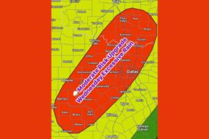
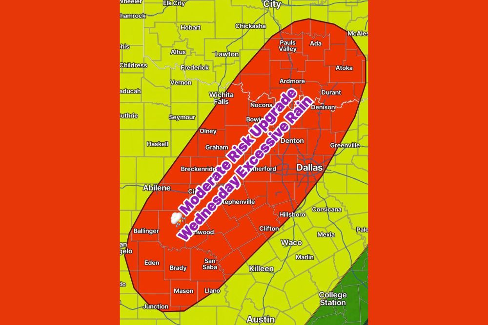
DALLAS, TX — A Moderate Risk for excessive rainfall has been issued for Wednesday across a large stretch of North and Central Texas and southern Oklahoma. A slow-moving cool front and an upper-level low are setting up a very heavy rain event. Two to four inches of rain are likely on Wednesday alone, with repeated rounds of heavy rain and lightning raising serious flooding concerns. The risk area covers the Dallas–Fort Worth Metroplex, Wichita Falls, Abilene, Ardmore and Durant, and it could affect millions of residents across the Red River Valley and the Texas Hill Country.
Slow-Moving Front and Upper Low Fuel the Heavy Rain
The setup behind Wednesday’s rain threat is a slow-moving cool front combined with an upper-level low. When both systems move slowly, storms can form and move over the same areas again and again, a process called training. That lets rain pile up fast, and that is why forecasters are highlighting a Moderate Risk, a Level 3 of 4 on the excessive rainfall scale.
Because the front is expected to stall or crawl across the region, several waves of heavy rain could hit the same communities through the day. Each round adds to the totals and worsens flooding in areas already soaked by earlier storms.
Moderate Risk Zone Stretches From the Hill Country to Southern Oklahoma
The Moderate Risk area runs in a long southwest-to-northeast corridor. It starts in the Texas Hill Country near Junction, Mason, Llano, Eden, Brady and San Saba, then continues northeast through Ballinger, Brownwood, Stephenville, Breckenridge and Graham. In North Texas, the zone covers Dallas, Denton, the Weatherford area, Hillsboro, Clifton, Bowie, Nocona, Olney and Wichita Falls.
Across the Red River into southern Oklahoma, the risk extends through Ardmore, Pauls Valley, Ada, Atoka, Durant and near Denison. Surrounding areas, including Waco, Killeen, Austin, San Angelo, Lawton, Chickasha, Corsicana and Greenville, fall under a lower but still notable risk for heavy rain and flooding.
Two to Four Inches Likely Wednesday Alone
The heaviest rain is expected on Wednesday, when 2 to 4 inches are likely across much of the Moderate Risk area. Totals like that in one day can overwhelm storm drains and fill creeks and streams quickly. Urban areas such as the Dallas–Fort Worth Metroplex are especially vulnerable, because pavement and concrete send rainwater straight into streets, underpasses and low spots.
In the Hill Country, rugged terrain and shallow soils can lead to fast-rising water in creeks, low-water crossings and river valleys. Rural areas across North Texas and southern Oklahoma could also see rising streams and flooded county roads as rain keeps falling.
Lightning and Rounds of Storms Add to the Danger
On top of the flooding threat, the storms are expected to bring frequent lightning. Anyone outdoors on Wednesday should head inside when thunder is heard and avoid open fields, tall trees and bodies of water. Commuters across the Metroplex should plan for slower travel, reduced visibility and possible road closures during the heaviest downpours.
Parents, school districts and employers should watch the forecast closely. Morning and evening commutes could be affected if heavy rain lines up with rush hour, especially on major routes such as Interstate 35, Interstate 20, Interstate 30 and U.S. Highway 287.
More Heavy Rain Thursday and Friday
The rain threat won’t end Wednesday. More heavy rain is expected Thursday and Friday as the slow-moving pattern continues over Texas and Oklahoma. With soils already saturated from Wednesday’s rain, even moderate totals on those days could cause new or worsening flooding.
By the weekend, conditions are expected to improve slightly, with lighter showers hanging around across the region. Rivers and larger streams may keep rising for a day or two after the heaviest rain ends as runoff moves downstream.
Flood Safety Reminders
Residents across the Moderate Risk area should get ready now. Clear gutters and storm drains, move vehicles out of flood-prone parking areas, and keep phones charged with Wireless Emergency Alerts turned on. Know whether your home, school or workplace sits in a low-lying area, and have a plan to move to higher ground if needed.
Most importantly, never drive through flooded roadways. Just 12 inches of moving water can carry away most cars, and roadbeds can wash out beneath the surface. Turn around, don’t drown.
For continuing coverage of this heavy rain event and weather developments across Texas, Oklahoma and the United States, visit diamondprowl.com.