
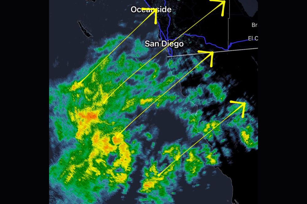
SAN DIEGO, CA — Tropical rain showers were heading for the Southern California coast Monday evening. Radar at 7:50 p.m. PDT showed several bands of rain moving in from the Pacific Ocean toward San Diego County. The showers were pushing northeast toward San Diego, Oceanside and El Cajon, with the heaviest cores still offshore to the southwest. Residents across coastal and inland San Diego County should be ready for periods of rain tonight as the tropical moisture moves ashore.
Radar Shows Multiple Rain Bands Offshore
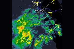
The 7:50 p.m. radar image showed a large area of rain spread across the Pacific southwest of San Diego and off the coast of northern Baja California. Several distinct rain bands were lined up from southwest to northeast, each moving toward the coast.
Most of the rain showed up as light to moderate green returns on radar. Pockets of yellow and orange marked heavier rain inside the bands. The most intense returns sat well offshore, southwest of San Diego, where a cluster of heavier showers was still organizing over open water.
Showers Moving Northeast Toward San Diego and Oceanside
The overall movement of the rain was toward the northeast. That puts the San Diego metro area, the North County coast near Oceanside, and inland communities including El Cajon in the path of the approaching showers.
The northernmost band was aimed at the coast near Oceanside, and another band was lined up to move over San Diego and inland toward El Cajon. More showers farther south were moving across northern Baja California and toward the U.S.–Mexico border region, where they could spread into southern San Diego County.
Rain Also Moving Across Northern Baja California
Along with the offshore bands, radar showed showers already moving over parts of northern Baja California, south of the border. Those showers were also drifting northeast and could reach the southern and eastern parts of San Diego County, including areas near the border and the inland foothills, later tonight.
The broad coverage of rain across the Pacific and Baja California shows how much tropical moisture is streaming north into the region. That moisture could keep shower chances going for a while as each band moves through.
What Residents Can Expect Tonight
As the showers come ashore, residents across San Diego County can expect periods of rain, with some bursts of heavier rain possible as the stronger cores move through. Rain may come and go instead of falling steadily, since the showers are arriving in separate bands.
Because tropical moisture can produce high rain rates in short bursts, some spots could see brief downpours even if overall totals stay modest. Coastal roads, low-lying streets and areas with poor drainage could see some ponding. After a long dry stretch, the first rain can also leave oil and debris on the pavement, making roads extra slick.
Travel Tips for a Wet Evening Commute
Drivers on Interstate 5, Interstate 8, Interstate 15 and State Route 94 should plan for wet roads and lower visibility if heavier showers move over the area. Slow down, leave extra following distance and turn on headlights when it’s raining. Motorcyclists and cyclists should be especially careful on slick pavement.
Anyone with evening outdoor plans along the coast, at local parks or at outdoor venues should keep an eye on radar. Showers may move in quickly as the bands push ashore from the ocean.
Watching the Tropical Moisture Overnight
Forecasters will keep watching how the tropical moisture evolves overnight and whether the heavier cores offshore hold together as they approach the coast. The exact timing and intensity of the rain could change as the bands move inland. Residents across San Diego County and the rest of Southern California should check updated forecasts and radar through the evening and overnight.
For continuing coverage of tropical rain and weather developments across Southern California and the United States, visit diamondprowl.com.