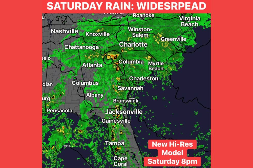
COLUMBIA, SC — The weekend is shaping up wet across the Southeast. The first high-resolution model run came in aggressive with Saturday’s rain, showing it becoming widespread from around lunchtime onward. By 8 p.m. Saturday, the model has nearly 1 to 2 inches already on the ground in some spots. One model run isn’t gospel, and later high-resolution runs may adjust the timing, but it’s another sign that Saturday could turn wet fairly quickly across South Carolina, Georgia and North Carolina. Periods of rain are then likely to continue Saturday night through much of Sunday before finally moving out by Monday morning.
Rain Turns Widespread by Saturday Afternoon
The new high-resolution model shows rain spreading across a large part of the Southeast by Saturday evening. Coverage stretches from Tennessee and North Carolina south through South Carolina, Georgia and Florida. Cities including Atlanta, Columbia, Charlotte, Charleston, Savannah, Jacksonville, Knoxville and Chattanooga are all under rain in the model at 8 p.m. Saturday.
Pockets of heavier rain show up near Columbia and in parts of the South Carolina Midlands, with more embedded downpours near Savannah, Jacksonville, Gainesville and Tampa. Rain also reaches north toward Winston-Salem, Greenville, North Carolina, and Roanoke, Virginia.
One Inch Baseline With 2 to 4 Inches Possible
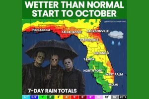
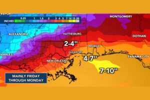
Forecasters still think about 1 inch of rain is a good baseline for most of the region. Some areas could get 2 to 4 inches, depending on where the heavier bands set up. Where those bands stall or move repeatedly over the same communities, totals could climb quickly and cause ponding on roads and localized flooding.
Low-lying areas, poorly drained streets and small creeks are most at risk if heavier rain develops, especially in urban areas around Columbia, Charlotte and Atlanta.
Rain Continues Saturday Night Into Sunday
After the first round Saturday, periods of rain are likely to continue Saturday night through much of Sunday. The rain may ease up at times but should stay fairly persistent across the region. Skies aren’t expected to fully clear until the system pulls away by Monday morning.
That means much of the weekend could be gray, damp and wet, with only brief breaks between rounds of rain.
Football Weekend Could Turn Soggy
The rain comes during a busy weekend of college football across the Southeast. Fans of Clemson, South Carolina and Georgia should be ready for wet conditions whether they’re heading to stadiums, tailgates or watch parties. Rain gear, ponchos and extra travel time are a good idea for anyone planning to be outdoors Saturday afternoon and evening.
Drivers on Interstate 26, Interstate 20, Interstate 85, Interstate 77 and Interstate 95 should plan for wet roads, reduced visibility and slower traffic during heavier downpours.
Timing Could Still Shift
Later high-resolution model runs may adjust when the rain arrives Saturday. It could start a little earlier or later than this model shows, and the location of the heaviest bands could also change. Forecasters will keep fine-tuning the timing as new guidance comes in through the end of the week.
Residents across South Carolina, Georgia and North Carolina should check updated forecasts before finalizing weekend plans and never drive through flooded roads.
For continuing coverage of the weekend rain and weather developments across the Southeast and the United States, visit diamondprowl.com.