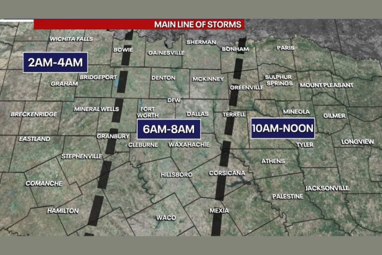
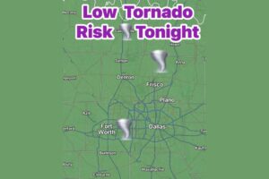
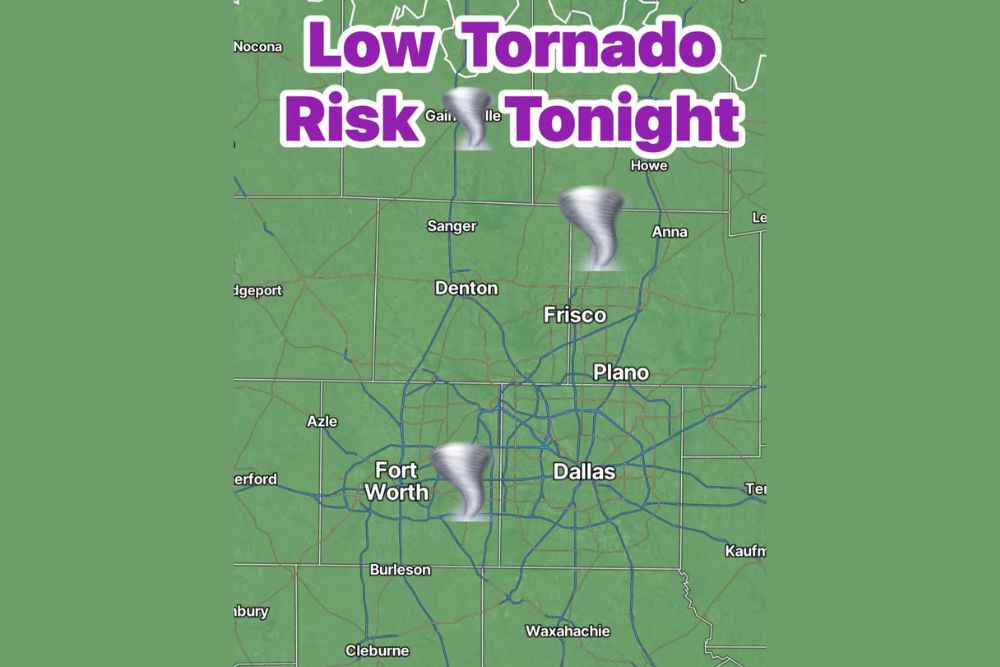
DALLAS, TX — The Storm Prediction Center has expanded the low-end tornado risk farther east to cover all of North Texas tonight. The atmosphere is expected to be capable of producing a low-end tornado or a quick spin-up overnight across the region, including the Dallas–Fort Worth Metroplex. The main risk overnight is still heavy rain and flash flooding, but forecasters say a brief tornado can’t be ruled out. Residents are urged to have multiple ways to receive warnings before going to bed.
Tornado Risk Expanded Across North Texas
The expanded risk area covers a wide stretch of North Texas, from Nocona and Gainesville near the Red River south through Denton, Frisco, Plano, Dallas and Fort Worth. It continues toward Burleson, Cleburne, Waxahachie, Italy, Itasca and Corsicana.
Communities north of the Metroplex, including Sanger, Anna and Howe, are also inside the risk area. So are areas west of Fort Worth, such as Azle, Weatherford, Bridgeport, Granbury and Glen Rose, along with Kaufman and Terrell to the east.
Quick Spin-Ups Possible Overnight
The tornado threat tonight is considered low-end, which means any tornadoes that form are likely to be brief and weak. Still, quick spin-ups can be dangerous. They often form fast inside heavy rain and leave little lead time before a warning is issued.
Because the risk extends overnight, many people may be asleep when storms move through. That makes it critical to have a way to wake up to warnings, such as a NOAA Weather Radio or Wireless Emergency Alerts turned on with the phone’s sound on.
Heavy Rain and Flash Flooding Remain the Main Threat
Even with the tornado risk, the bigger concern overnight is heavy rain and flash flooding. Repeated rounds of heavy rain across North Texas could quickly overwhelm storm drains and cause street flooding, especially in urban areas of Dallas, Fort Worth, Denton, Plano and Frisco.
Creeks, streams and low-water crossings could rise fast during intense downpours. Areas that have already had heavy rain earlier this week are especially vulnerable, since saturated ground can’t soak up much more water.
Overnight Travel Could Be Dangerous
Drivers should avoid unnecessary travel overnight if possible. Flooded roads are much harder to see in the dark, and water can be deeper and faster than it looks. Roadways along Interstate 35, Interstate 30, Interstate 20, U.S. Highway 75 and the Dallas North Tollway could see standing water and flooded sections during heavier rain.
Never try to drive through flooded roads. Just 12 inches of moving water can sweep away most vehicles, and roadbeds can wash out beneath the surface.
How to Prepare Tonight
Residents across North Texas should take a few simple steps before bed:
Keep phones charged and make sure Wireless Emergency Alerts are turned on.
Have a NOAA Weather Radio or another alert source that can wake you up.
Know your safe place, such as an interior room on the lowest floor away from windows.
Keep shoes, a flashlight and a charged phone close by in case you need to take shelter quickly.
Stay Alert Through the Night
Conditions could change quickly as storms develop and move across the region overnight. Residents should watch for updates from the National Weather Service in Fort Worth and take any tornado or flash flood warnings seriously.
For continuing coverage of the tornado risk, flash flooding and weather developments across North Texas and the United States, visit diamondprowl.com.