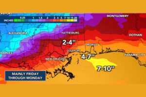
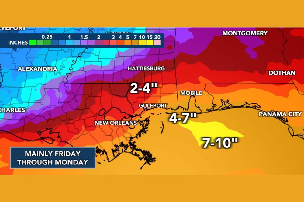
GULFPORT, MS — The highest rainfall totals forecast for the northern Gulf Coast have shifted slightly offshore and east of South Mississippi. That’s encouraging news for residents and cruise passengers heading out this weekend, but the region isn’t in the clear yet. The latest 7-day projected rainfall, through Wednesday, October 7, still shows 2 to 4 inches across much of South Mississippi. Totals of 4 to 7 inches are possible near Mobile, and 7 to 10 inches offshore in the Gulf. Most of the rain is expected Friday through Monday, October 2–5.
Heaviest Totals Shift East and Offshore
The newest rainfall projection moves the heaviest rain away from the Mississippi Gulf Coast and toward the waters east of the region. A large area of 7 to 10 inches sits offshore in the Gulf of Mexico, south of Mobile and the Alabama coastline, west of the Florida Panhandle.
Closer to land, the 4 to 7 inch range covers coastal Alabama, including Mobile, and stretches along the Gulf Coast toward Pensacola and Panama City. If this trend continues, South Mississippi could avoid the heaviest rain.
South Mississippi Still Expects 2 to 4 Inches
Even with the shift, South Mississippi is still projected to get 2 to 4 inches over the next seven days. That includes Gulfport, Biloxi and the communities along the Mississippi Gulf Coast, as well as inland areas toward Hattiesburg.
Southeast Louisiana, including New Orleans, falls in a similar range of about 2 to 4 inches, with lighter totals farther north and west toward Alexandria. Heavier amounts of 3 to 5 inches are projected across southern Alabama, extending north toward Montgomery.
Rain Won’t Fall Non-Stop
Forecasters stress that the rain won’t be falling non-stop over this period. There will be breaks between rounds of showers and storms, so some hours, and possibly parts of days, may stay dry.
The bigger concern is that deep tropical moisture in place will let storms that do form produce heavy rain in a short amount of time. In South Mississippi, that kind of quick, intense rain often leads to flooding issues, especially in low-lying neighborhoods and areas with poor drainage.
Flash Flooding Risk Saturday and Sunday
Flash flooding outlooks for Saturday and Sunday show a slight risk for much of the region, including Gulfport, Hattiesburg, Baton Rouge, New Orleans, Mobile, Monroeville and Pensacola. On Saturday, part of the slight risk area extends offshore and across the Gulf Coast of Alabama and the Florida Panhandle.
By Sunday, the slight risk continues across much of South Mississippi, southeast Louisiana and southern Alabama. Northwest areas near Hattiesburg and inland Louisiana drop to a marginal risk.
Weekend Cruisers Watching Closely
The shift in rainfall is welcome news for cruise passengers departing from the Gulf Coast this weekend. Even so, travelers should expect periods of rain and possible delays heading to and from ports, and should check with their cruise line for updates. Rough weather offshore, where the heaviest totals are now projected, could still affect conditions at sea.
Flood Safety Reminders
Residents should clear gutters and storm drains and watch for water on roadways during heavier storms. Never drive through flooded streets. Just 12 inches of moving water can sweep away most vehicles. Turn around, don’t drown.
For continuing coverage of heavy rain along the Gulf Coast and weather developments across the United States, visit diamondprowl.com.