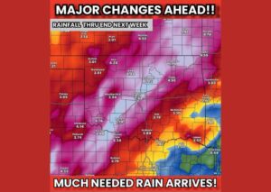
ROCKFORD, IL — Weather models are pointing to another very wet stretch ahead for the Midwest early to mid next week, with multiple rounds of showers and thunderstorms expected to bring heavy rain and increasing flood threats, particularly across northwest Illinois into Iowa. Forecasters say Tuesday through Thursday will be the primary focus for the heaviest rainfall, though there is currently no risk of severe weather expected alongside the rain.
Multiple Rounds of Rain Raise Flood Concerns
The forecast calls for several separate rounds of showers and thunderstorms moving through the region over the coming week, a pattern that raises the risk of flooding as repeated rainfall accumulates on top of already-saturated ground. Rather than a single, isolated rain event, this setup involves multiple waves of precipitation tracking through the same general area, a scenario that tends to produce more significant cumulative rainfall totals than an isolated storm system passing through just once.
This kind of repetitive rainfall pattern is particularly concerning for flood potential, since each additional round of rain arrives before the ground and local waterways have had adequate time to fully drain the previous round’s precipitation.
Northwest Illinois and Iowa Face the Heaviest Totals
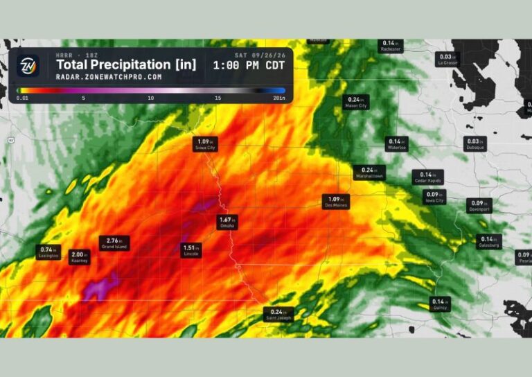
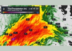
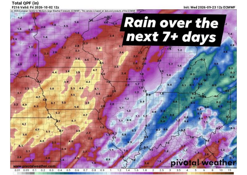
A seven-day precipitation outlook valid through Friday, October 2, shows the heaviest rainfall totals concentrated across a broad swath of northwest Illinois and Iowa, with numerous locations projected to see between 4 and 6 inches of total rainfall over the period. Some areas show even higher localized totals approaching 6 inches or more, reflecting the potential for training storms to repeatedly track over the same communities and significantly boost accumulated rainfall in those specific locations.
Communities throughout this corridor should anticipate the possibility of standing water and localized flooding given the sheer volume of rain forecast to fall within a relatively compressed timeframe heading into and through the middle of next week.
Tuesday Through Thursday the Focus for Heaviest Rain
Forecasters have identified Tuesday through Thursday as the window when the heaviest rainfall and greatest flood threat are expected to materialize across the affected region. This multi-day focus period reflects the timing of the multiple rounds of showers and thunderstorms expected to track through the Midwest, with the cumulative effect of several systems moving through in relatively close succession driving the elevated flood concern during this specific stretch of days.
Residents across northwest Illinois and Iowa in particular should closely monitor forecasts as this multi-day period approaches, given the potential for rainfall totals in the higher end of the projected range to translate into meaningful flooding impacts along local waterways and in low-lying or flood-prone areas.
Rainfall Extends Across a Broad Portion of the Midwest
While northwest Illinois and Iowa are expected to see the heaviest totals, the broader precipitation outlook shows meaningful rainfall extending across a wide stretch of the Midwest, including much of Illinois, Wisconsin, and portions of Indiana. Totals farther east and south generally taper off compared to the northwest corridor, though even these areas should expect measurable rainfall as the multiple rounds of showers and storms continue tracking through the region over the coming week.
No Severe Weather Risk Currently Expected
Despite the significant rainfall and associated flood concerns, forecasters emphasize that there is currently no risk of severe weather anticipated alongside this system as it stands now. This distinction is important for residents preparing for the coming week, as the primary hazards associated with this pattern are expected to remain centered on heavy rainfall and potential flooding rather than damaging winds, large hail, or tornadic activity typically associated with more severe convective setups.
For continuing coverage of severe weather events and critical storm analysis across the United States, visit diamondprowl.com.