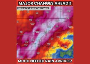
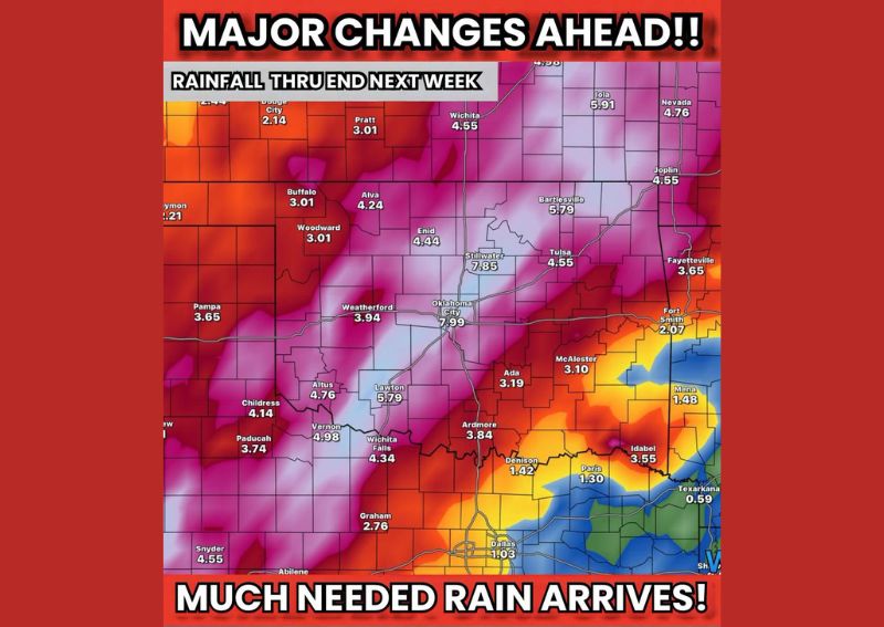
OKLAHOMA CITY, OK — A major pattern change is on the way for Oklahoma and Texas, with forecasters highlighting a significant signal for beneficial rain and storms expected to begin as early as next week and continuing into October. Rainfall projections through the end of next week show some locations potentially seeing totals approaching 8 inches, a dramatic shift for a region that has been in need of meaningful precipitation.
Oklahoma City and Stillwater See the Highest Totals
Rainfall projections through the end of next week show some of the most significant totals concentrated across central Oklahoma, with Oklahoma City projected to receive as much as 7.99 inches and nearby Stillwater forecast to see 7.85 inches. These substantial totals place central Oklahoma at the heart of what forecasters are calling a major signal for much-needed rainfall, representing a significant and potentially transformative precipitation event for the region.
Additional communities across northeastern Oklahoma, including Bartlesville at 5.79 inches and Iola at 5.91 inches, are also positioned to see substantial rainfall totals as the system moves through, underscoring just how widespread this potential rain event could become across the state.
Widespread Rainfall Extends Across Much of Oklahoma
Beyond the highest-total areas, the broader rainfall outlook shows meaningful precipitation extending across a wide swath of Oklahoma, with communities including Enid, Weatherford, and Lawton all projected to see totals in the 4 to 6 inch range. Even areas toward the western edge of the outlook, such as Woodward and Alva, are forecast to receive 3 to 4 inches, indicating that this potential rain event could bring meaningful relief across nearly the entire state rather than remaining confined to a narrow corridor.
This kind of widespread coverage suggests the incoming pattern change involves a broad area of enhanced moisture and lift, rather than a narrow, isolated band of heavy rain limited to just a few communities.
Texas Panhandle and North Texas See Lower but Still Notable Totals
While the heaviest totals are concentrated across Oklahoma, portions of the Texas Panhandle and North Texas are also positioned to see meaningful rainfall from this system. Communities including Wichita Falls at 4.34 inches and Childress at 4.14 inches show solid totals, while areas closer to Dallas are projected to see comparatively lighter amounts around 1.03 inches as the heaviest rain axis remains focused farther north and west.
This kind of north-to-south gradient in rainfall totals reflects the typical positioning of a storm system’s most active moisture transport, with the areas closest to the system’s center generally seeing the most substantial precipitation totals.
Potential for Severe Weather Also on the Table
Forecasters note that this major pattern change could bring more than just beneficial rainfall, with the potential for severe weather also being discussed as a possibility alongside the incoming storms. Given the scale of moisture and atmospheric changes associated with this system, residents across Oklahoma and Texas are encouraged to stay closely tuned to forecast updates in the coming days as confidence in the exact timing, coverage, and potential severe weather threat continues to be refined heading into next week.
For continuing coverage of severe weather events and critical storm analysis across the United States, visit diamondprowl.com.