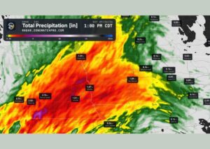
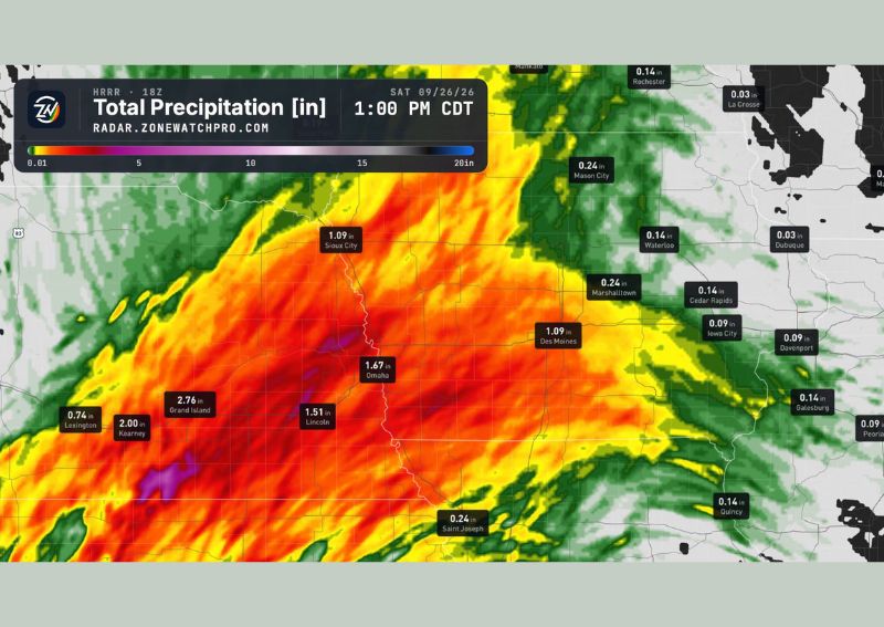
OMAHA, NE — Heavy rain is targeting Nebraska and western Iowa this Saturday, with forecast rainfall totals valid through 1 PM Central Time showing widespread heavy precipitation across a broad swath of the region. Omaha is projected to see approximately 1.67 inches of rain, while Grand Island to the west is forecast to receive an even higher total of 2.76 inches as the system moves through the area.
Grand Island and Kearney See the Heaviest Totals
The highest projected rainfall totals are concentrated across south-central Nebraska, with Grand Island leading the region at 2.76 inches and nearby Kearney close behind at 2.00 inches. This corridor of heavier rainfall reflects the core of the precipitation shield moving through the state, with radar imagery showing intense red and orange coloration indicating the most significant rainfall rates concentrated across this stretch of central Nebraska.
Communities farther west, including Lexington at 0.74 inches, show comparatively lighter totals, illustrating how the heaviest rainfall band is concentrated in a fairly defined corridor rather than spreading evenly across the entire western half of the state.
Omaha and Lincoln Also See Significant Rainfall
Eastern Nebraska communities are also seeing substantial rainfall from this system, with Omaha projected at 1.67 inches and Lincoln close behind at 1.51 inches. These totals, while somewhat lower than the peak amounts farther west near Grand Island, still represent a significant rainfall event for the state’s two largest metropolitan areas, with the potential for localized ponding and travel impacts given the concentrated nature of the precipitation.
The consistency of rainfall totals across both Grand Island and the Omaha-Lincoln corridor suggests a broad, well-organized area of precipitation rather than isolated, scattered showers limited to just a few specific locations within the state.
Western Iowa Sees Notable Totals as Well
Just across the state line in western Iowa, Sioux City is forecast to receive 1.09 inches of rain, matching the total projected for Des Moines farther east. These totals indicate that the heavier rainfall band extends beyond Nebraska’s eastern border into portions of western Iowa, affecting communities along the Missouri River corridor as the broader precipitation system continues its eastward progression through the region.
Rainfall totals generally taper off farther east across Iowa, with communities including Cedar Rapids, Iowa City, and Davenport projected to see considerably lighter totals in the 0.09 to 0.24 inch range, reflecting the diminishing intensity of the system as it moves away from its most active core over Nebraska.
Continued Monitoring Through the Weekend
With substantial rainfall totals forecast across both Nebraska and western Iowa, residents throughout the affected region should stay aware of the potential for localized flooding and reduced visibility as the heavier bands of rain move through on Saturday. Forecasters will continue tracking the system’s progression as it moves through the region, providing updated guidance on final rainfall totals as the precipitation event unfolds throughout the day.
For continuing coverage of severe weather events and critical storm analysis across the United States, visit diamondprowl.com.