MIDLAND, TX — The remnants of Major Hurricane Polo are heading into the Southern Plains and Desert Southwest. They are bringing a deep surge of tropical moisture that makes heavy rainfall and flash flooding the main concerns for parts of New Mexico, Texas and Oklahoma this week. There is also a low-end risk for severe thunderstorms. Starting late Tuesday into Wednesday, the leftover energy and circulation from Polo will move over the region and interact with an approaching upper-level storm system. That setup could support a few stronger storms capable of isolated damaging wind gusts and possibly a brief tornado.
How Polo’s Remnants Could Fuel Stronger Storms
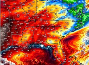
As Polo’s leftover circulation moves inland, it will add extra spin to the atmosphere across the region. Combined with the approaching upper-level storm system, increasing wind shear and a deep plume of tropical moisture, this could create an environment that supports a few stronger thunderstorms. Tropical remnants often produce quick, low-topped rotating storms. These can form and fade within minutes, which makes them hard to spot and warn for.
Even so, the severe threat is expected to stay low-end. Forecasters are watching for scattered storms that briefly turn strong, not a widespread severe weather outbreak.
Southern New Mexico and West Texas in the Main Target Zone
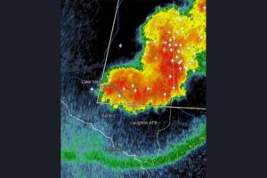
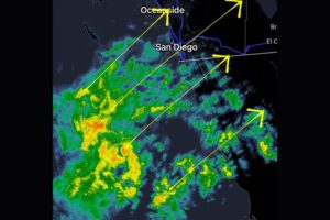
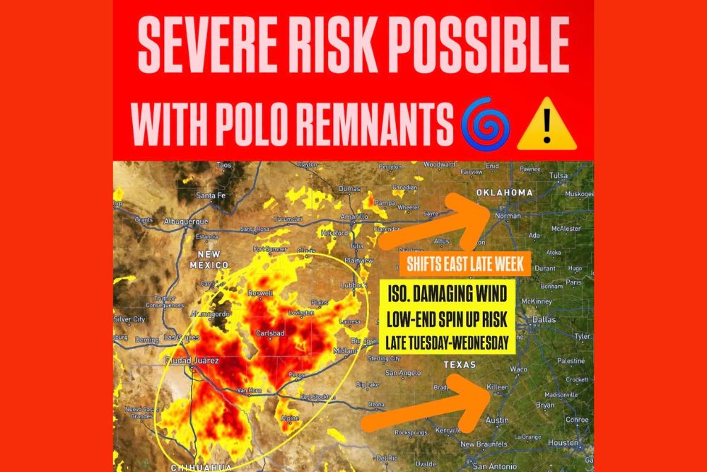
Radar and forecast imagery point to the heaviest rain and highest storm potential across southern New Mexico and West Texas. The outlined risk area covers communities including Las Cruces, Alamogordo, Roswell, Carlsbad, Lovington and Hobbs in New Mexico. In Texas, it extends through Lubbock, Lamesa, Big Spring, Midland, Pecos and Van Horn. The moisture also reaches south into Chihuahua in northern Mexico, near Ciudad Juárez.
Inside this zone, the strongest storms could bring isolated damaging wind gusts and a low-end spin-up risk from late Tuesday through Wednesday. Residents across the Permian Basin, South Plains and southeastern New Mexico should have a reliable way to get weather alerts, especially overnight.
Heavy Rain and Flash Flooding Remain the Primary Threat
The biggest danger from Polo’s remnants is heavy rainfall and flash flooding. Tropical moisture can produce very high rain rates in short periods of time. Across the dry terrain of West Texas and New Mexico, that rain can quickly run off hard ground and fill arroyos, low-water crossings, draws and urban streets.
Areas near the Sacramento Mountains, the Guadalupe Mountains and other higher terrain may be especially prone to fast runoff. Drivers should never try to cross flooded roads. Just a few inches of fast-moving water can sweep a vehicle away, and flooded crossings are often deeper than they look, especially at night.
Threat Shifts East Late Week Toward Oklahoma and Central Texas
By Thursday and Friday, the heavy rain and low-end severe thunderstorm threat should gradually shift east. It could affect more of the Southern Plains and surrounding areas. Forecast graphics show the activity spreading toward western and central Oklahoma, including areas near Altus and Norman, and into Central Texas, including the Killeen, Austin and Hill Country regions.
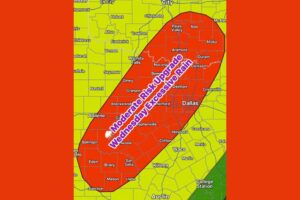
Communities along the Interstate 35 corridor, including Dallas, Waco, Austin and San Antonio, should watch how Polo’s remnants evolve as the week goes on. The exact track will decide which areas get the heaviest rain and whether any stronger storms reach farther east.
No Official SPC Severe Risk Yet
For now, the Storm Prediction Center has not issued an official severe weather risk for the region. That could change as the setup becomes clearer and forecast models get a better handle on Polo’s remnant circulation. The size and placement of the severe threat will depend heavily on the track and evolution of the leftover system as it moves inland and meets the incoming upper-level trough.
Staying Prepared Through the Week
Residents across New Mexico, Texas and Oklahoma should keep checking forecasts from their local National Weather Service offices through the week. Make sure phones can receive Wireless Emergency Alerts and know where the safest room in your home is if a warning is issued. Plan extra travel time on rural highways, where heavy rain and poor visibility can develop quickly. With this evolving setup, conditions could change fast from late Tuesday through the end of the week.
For continuing coverage of Hurricane Polo’s remnants and weather developments across the United States, visit diamondprowl.com.