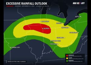



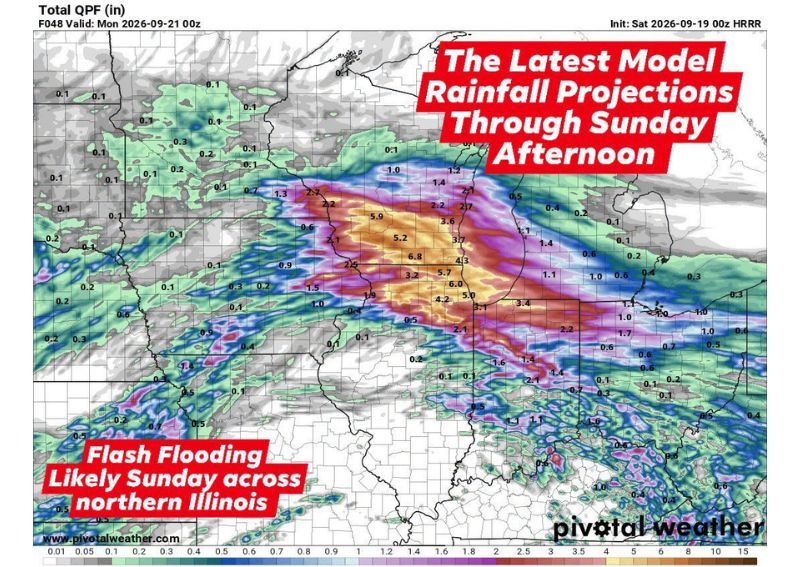
NORTHERN ILLINOIS — Weather models continue to show torrential rainfall developing across northern Illinois beginning early Saturday morning and persisting through Sunday afternoon, with forecasters warning of widespread, significant rainfall accumulations capable of producing flash flooding. Multiple separate rounds of heavy rain are expected to move through the region over the weekend, with total rainfall amounts projected to reach 2 to 4 inches across much of northern Illinois and isolated totals of 4 to 6 inches or more possible in the hardest-hit spots by Sunday night.
First Round Arrives Early Saturday Morning
The initial wave of torrential rainfall is expected to begin between 1 AM and 4 AM Saturday, continuing through the lunchtime hours before gradually easing during Saturday afternoon. Scattered showers and thunderstorms are forecast to persist off and on through Saturday night, with some drier stretches mixed in between the more active periods. Forecasters caution that anyone with outdoor plans during this window should expect the possibility of sudden, heavy downpours capable of quickly reducing visibility and creating hazardous travel conditions.
Second Round Targets Sunday Morning
A second round of heavy rain is projected to develop late Saturday night, generally after 10 PM, and continue overnight into the Sunday morning hours. The heaviest rain and thunderstorms associated with this second wave are expected to shift eastward by lunchtime Sunday, though additional showers and thunderstorms are forecast to develop and move through during Sunday afternoon into Sunday evening, keeping the flash flooding threat active through much of the day.
Flash Flooding Risk Concentrated in Urban Areas
Forecasters specifically highlight flash flooding as a likely outcome across portions of northern Illinois, with urban areas facing an elevated risk due to impervious surfaces limiting how quickly heavy rainfall can drain. The combination of multiple rounds of torrential rain falling within a relatively short overall timeframe raises the likelihood of rapid water accumulation on roadways and in low-lying neighborhoods, particularly as the ground becomes increasingly saturated with each additional round of rainfall.
River and Stream Levels Bear Watching
Beyond the urban flash flooding concern, residents living near rivers and streams across northern Illinois are urged to stay alert for the possibility of rapid rises given the substantial rainfall totals expected through the weekend. With projected accumulations reaching as high as 6 inches or more in some areas, waterways draining the hardest-hit portions of the region could see significant and fast-developing increases in flow, particularly heading into Sunday night as the second round of rain wraps up.
For continuing coverage of severe weather events and critical storm analysis across the United States, visit diamondprowl.com.