


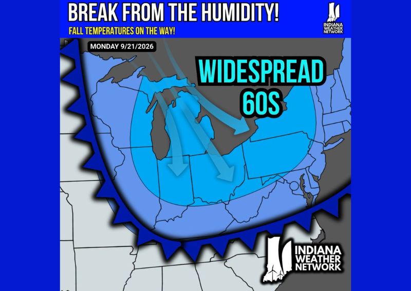
INDIANAPOLIS, IN — A widespread push of cooler, drier air is forecast to sweep across Indiana and a large portion of the Midwest heading into Monday, September 21, bringing widespread 60s and a significant break from the sticky humidity that has lingered through much of the summer and early fall. Forecasters describe the incoming pattern as a genuine taste of fall temperatures, with the air mass expected to stretch across a broad region rather than remaining confined to a small pocket of the country.
Wide Coverage Area Expected
The cooler air mass is projected to blanket an unusually large footprint, extending from the Great Lakes region southward across much of the Ohio Valley and into portions of the central United States. Arrows on forecast graphics illustrate the air mass diving southward and eastward from the Upper Midwest, indicating that the cooler conditions will not simply pass through quickly but instead settle in across a wide swath of territory as the new week begins.
Humidity Drop Brings Comfort Alongside Cooler Air
Beyond the drop in temperatures themselves, forecasters emphasize that the accompanying reduction in humidity will play a major role in how noticeably different conditions feel outdoors. Lower humidity levels paired with widespread 60s typically translate into far more comfortable conditions for outdoor activities compared to the muggy, oppressive feel that has characterized much of the recent stretch. This combination of cooler air and drier conditions is often what gives an early fall push its most noticeable impact on daily life.
Timing Centers on Start of the Work Week
The bulk of the cooler, less humid air is expected to arrive by Monday, September 21, positioning the shift to coincide with the start of the work week for much of the affected region. This timing means residents across Indiana and neighboring states could see the transition play out during their Monday morning commute, with noticeably cooler and less humid air greeting those heading out the door compared to recent mornings.
Regional Scope Reflects a Broader Pattern Shift
The sheer scale of the forecast cooler air, stretching across multiple states and encompassing a large portion of the nation’s midsection, points to a broader shift in the overall weather pattern rather than a brief, localized cool down. Forecasters note that this kind of widespread coverage typically signals a more substantial change in the jet stream pattern, which can sometimes set the stage for continued below-normal temperatures in the days following the initial arrival of the cooler air mass.
For continuing coverage of severe weather events and critical storm analysis across the United States, visit diamondprowl.com.