


BIRMINGHAM, AL — Weather models are showing signs of a cool front pushing into the region by next Friday, September 25, offering Alabama a partial break from the oppressive late-summer heat that has gripped the state throughout much of September. A sharp blast of Canadian air is forecast to dive south over the coming week, but forecasters caution that the true chill will remain largely bottled up across the Midwest and Ohio Valley, with Alabama receiving only a glancing blow from the broader cold air mass.
What Alabama Can Expect From the Front
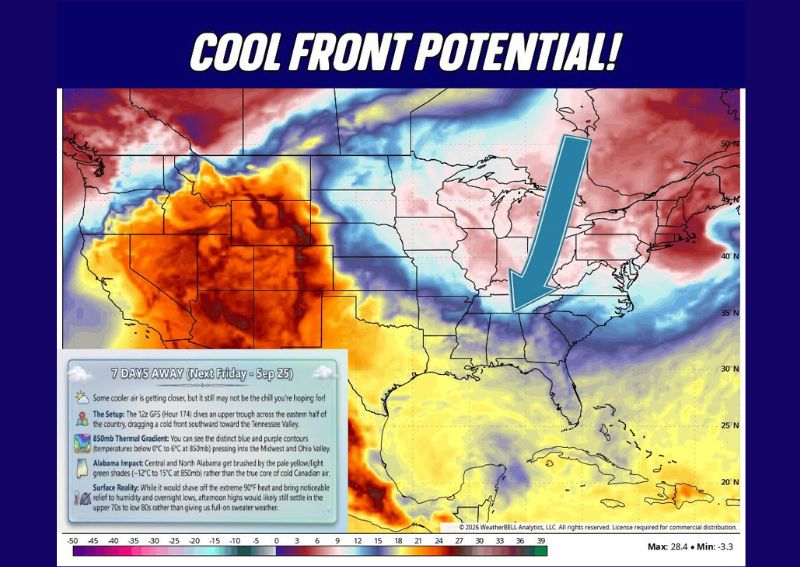
According to current model guidance, Alabama will get enough of a push from the approaching cool front to knock out the miserable 90-degree heat that has dominated recent weeks and strip away much of the oppressive humidity. However, afternoon highs by next Friday are still likely to hover in the upper 70s to low 80s, meaning the relief will be noticeable but far from a full transition into true fall weather for the state.
Mornings Set to Feel the Biggest Improvement
The most tangible improvement tied to this pattern is expected to show up during the morning hours rather than the afternoon. Forecasters say morning conditions are likely to feel dramatically better, with outdoor activities no longer accompanied by the heavy humidity and sweat-inducing warmth that has characterized recent mornings. This kind of shift often provides the first noticeable sign of a seasonal transition, even before afternoon highs drop significantly.
The Setup Behind the Cooler Air
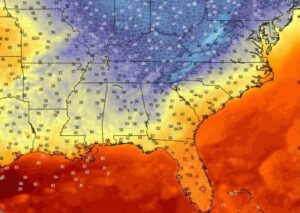
The pattern driving this potential relief involves an upper-level trough diving across the eastern half of the country roughly seven days out, dragging a cold front southward toward the Tennessee Valley. Thermal gradient data at the 850-millibar level shows a sharp contrast developing, with much colder air settling into the Midwest and Ohio Valley while central and northern Alabama are brushed by a more moderate air mass rather than the core of the Canadian cold plunge.
Confidence Still Developing This Far Out
Forecasters emphasize that this outlook remains rooted in extended-range model data, meaning both the timing and intensity of the cooler push could shift as the forecast period draws closer. While the surface reality suggests Alabama will see meaningful relief from the most extreme heat and humidity, residents should not expect the front to deliver a true early taste of fall, with afternoon temperatures likely remaining well short of the sweater-weather conditions some may be hoping for.
For continuing coverage of severe weather events and critical storm analysis across the United States, visit diamondprowl.com.