PUEBLO, CO — A surge of monsoon moisture is bringing a broad area of rain with embedded thunderstorms into southern Colorado tonight and continuing into Thursday, with the system moving in out of New Mexico and mainly impacting areas south of the Interstate 76 corridor. Most of the rainfall over the past day has already concentrated across southern Colorado, while areas farther north and west saw more scattered showers and storms along the Western Slope, Palmer Divide, and Cheyenne Ridge.
Southern Colorado Sees the Bulk of the Rain
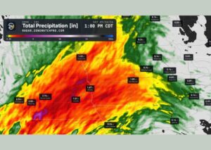
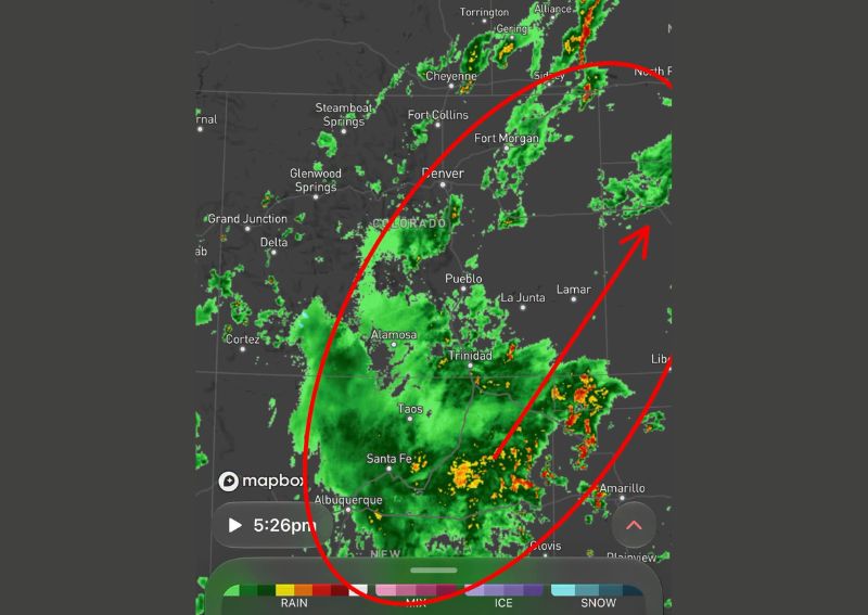
Radar imagery shows the most significant and widespread rainfall concentrated across southern Colorado, extending from the San Luis Valley near Alamosa through Trinidad and into New Mexico near Santa Fe and Taos. This concentration of heavier rain in the southern part of the state reflects the primary track of the monsoon moisture feeding into the region, with the most intense storm cores producing locally heavy rainfall rates within the broader area of coverage.
Forecasters note that rain totals will generally increase the farther south one travels into southern Colorado, as well as the farther east across the plains toward western Kansas, reflecting the overall orientation and movement of the moisture plume driving this event.
Northern Front Range Stays Quieter
The northern Front Range, including areas around Fort Collins and Denver, experienced a notably quieter day compared to the more active southern half of the state. Cloud cover kept temperatures cooler for much of the day, which limited the atmospheric instability needed to support more widespread thunderstorm development, even with the surge of monsoon moisture moving into the broader region.
This dynamic, where cooler temperatures driven by persistent cloud cover actually suppress storm development despite ample available moisture, illustrates how instability and moisture must both align for widespread thunderstorm activity to take hold across a given area.
Broad Rain and Thunderstorms Expected Tonight and Thursday
Looking ahead, forecasters expect a broad area of rain accompanied by embedded thunderstorms to move into southern Colorado overnight and continuing through Thursday, with the moisture plume originating out of New Mexico. This activity will primarily impact areas south of the I-76 corridor, keeping the most significant rainfall and storm coverage concentrated across the southern half of the state through the coming day.
The extended duration of this event, spanning both tonight and into Thursday, suggests a more prolonged period of unsettled weather for southern Colorado compared to a brief, single-day round of showers and storms.
Wet Snow Possible Above Timberline
Given sufficiently high elevations in the central and southern mountains, some of the precipitation associated with this system is expected to fall as wet snow above timberline, even as rain continues at lower elevations throughout southern Colorado. This kind of elevation-dependent precipitation type is a routine feature of Colorado weather, where a single storm system can simultaneously produce rain in valleys and snow at the highest peaks depending on temperature profiles at different elevations.
Forecasters plan to continue monitoring the storm’s progression through the overnight hours and into Thursday, providing updates as the rain and thunderstorm activity continues to unfold across southern Colorado and the surrounding region.
For continuing coverage of severe weather events and critical storm analysis across the United States, visit diamondprowl.com.