DALLAS, TX — A fall cold front is set to bring a modest pattern change across Texas next week, with forecasters projecting daytime highs to drop into the 80s across much of the state from Tuesday through Friday, September 29 through October 2. While this won’t represent a huge push of cold air, meteorologists say some model guidance is trending even cooler by late next week, with the potential for several days of clouds and rain also increasingly likely as the front moves through the region.
A Modest but Noticeable Temperature Shift
The incoming cold front is not expected to deliver a dramatic cool down, but forecasters emphasize that the shift will still be noticeable, particularly given the run of warm conditions that has persisted across Texas in recent weeks. Daytime highs dropping into the 80s would represent a meaningful, if modest, departure from the hotter late-summer pattern that has dominated much of the state, offering residents a genuine early taste of fall-like conditions as the calendar turns toward October.
Some longer-range model guidance suggests the cooling trend could become more pronounced by the latter part of the forecast window, hinting at the possibility of an even more significant pattern shift than currently anticipated if that cooler guidance continues to be supported by subsequent model runs.
Increased Rain Chances Accompany the Front
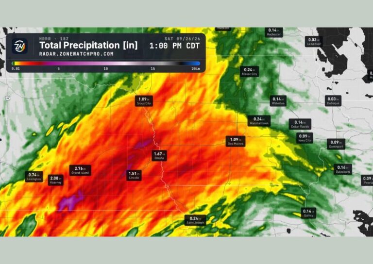
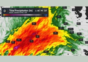
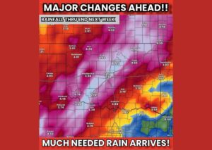
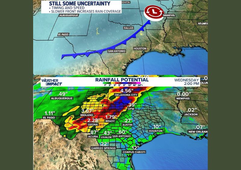
Beyond the temperature impacts, forecasters are highlighting a significant increase in rain chances associated with this frontal passage. Rainfall potential graphics valid through Wednesday at 2 PM show substantial projected totals across a wide swath of the state, with Oklahoma City potentially seeing as much as 4.56 inches and Midland projected to receive around 3.67 inches. Communities including Ozona, Brady, and El Paso are also highlighted with notable rainfall totals ranging from roughly 1 to 2.3 inches.
This widespread and locally heavy rainfall potential suggests the frontal boundary could produce more than just a passing shower for many communities, with some areas positioned to see genuinely significant precipitation totals over the multi-day period.
Timing and Speed Remain Uncertain
Forecasters caution that meaningful uncertainty still surrounds this system, particularly regarding the exact timing and forward speed of the approaching front. A slower-moving front would tend to increase overall rain coverage and duration across the state, while a faster-moving system could limit both the extent and total accumulation of rainfall associated with the pattern change. This uncertainty means the eventual rainfall distribution and totals could shift meaningfully from current projections as the system draws closer.
What to Watch For Heading Into Next Week
With cooler weather and increased rain chances both arriving by the middle of next week, forecasters are urging residents across Texas to stay weather aware as the system approaches. Should the front produce the several days of clouds and rain currently being modeled, this pattern change would likely verify as a legitimate and welcome shift away from the persistent late-summer heat that has characterized much of the state’s recent weather.
For continuing coverage of severe weather events and critical storm analysis across the United States, visit diamondprowl.com.