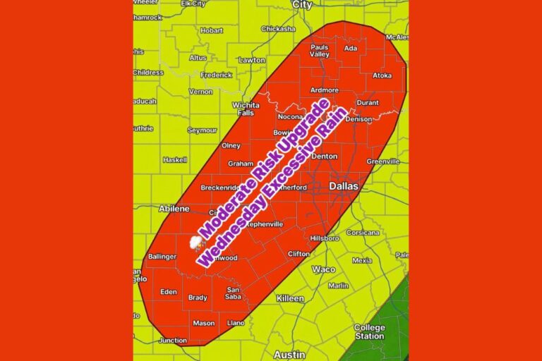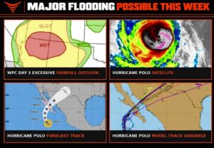

DALLAS, TX — Flash flooding is likely to impact the central and southern United States later this week, as Hurricane Polo begins its trek over Mexico and toward the central US, bringing abundant moisture as it phases with an upper-level low swinging in from the west. This combination is expected to result in widespread rainfall across the Plains, with North Texas in particular facing its greatest flooding potential on Wednesday and Thursday.
Dry Soils Amplify the Flooding Risk
Meteorologists are highlighting a critical factor that could make this rain event more dangerous than it might otherwise be: the current dry state of soils across the region. Given how dry soils have become, forecasters warn that it doesn’t take a lot of rainfall to produce flooding. Dry soil can become hydrophobic, meaning it develops a water-repellent surface layer that struggles to absorb heavy rainfall quickly, resulting in significant runoff and potentially serious flooding even from rainfall totals that might not otherwise raise major concern.
This hydrophobic soil phenomenon is a well-documented risk during the transition from an extended dry period into a heavy rain event, as the parched ground essentially sheds water rather than soaking it in, sending large volumes of runoff into streams, rivers, and low-lying areas in a short amount of time.
Widespread Heavy Rainfall Expected Across the Plains
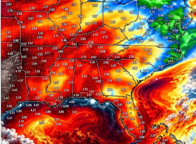
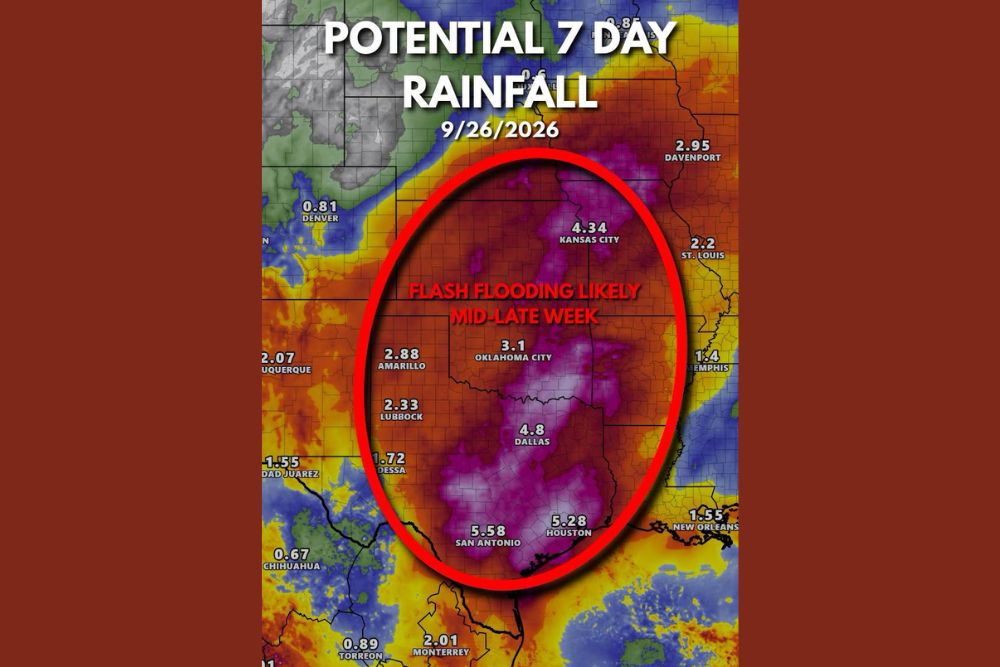
A seven-day rainfall projection valid through September 26, 2026, shows a broad zone of significant rainfall potential stretching across much of the southern Plains, with the heaviest totals concentrated in a corridor highlighted as facing likely flash flooding mid-to-late week. Communities including Oklahoma City at 3.1 inches, Dallas at 4.8 inches, and Kansas City at 4.34 inches are all positioned within this elevated rainfall zone.
Farther south, projected totals climb even higher, with San Antonio forecast to see as much as 5.58 inches and Houston close behind at 5.28 inches, reflecting the substantial moisture transport expected as Polo’s tropical moisture becomes incorporated into the broader storm system.
North Texas Faces Greatest Risk Wednesday and Thursday
Forecasters are specifically eyeing Wednesday and Thursday as the days carrying the greatest flooding potential for North Texas. This timing reflects when the phasing between Hurricane Polo’s moisture plume and the approaching upper-level low is expected to be most complete, creating the most favorable conditions for widespread, potentially intense rainfall across the Dallas-Fort Worth area and surrounding communities during the middle of the work week.
Rainfall Totals Remain Highly Uncertain
Despite the concerning setup taking shape, forecasters emphasize that specific rainfall totals remain highly uncertain at this stage, given how dependent the outcome is on Polo’s exact track as it moves inland. While current projections suggest North Texas could see a couple of inches of rain by the end of the work week, meteorologists caution that this forecast will likely continue to evolve as Polo’s path becomes clearer in the coming days.
Residents Urged to Stay Updated
Given the combination of dry, flood-prone soils and the potential for a significant, moisture-laden rain event, residents across the central and southern United States, particularly in North Texas, are encouraged to closely monitor forecast updates throughout the week. As forecasters continue to stress, this outlook will change as Hurricane Polo’s track and the timing of its interaction with the approaching trough become better defined in the days ahead.
For continuing coverage of severe weather events and critical storm analysis across the United States, visit diamondprowl.com.