


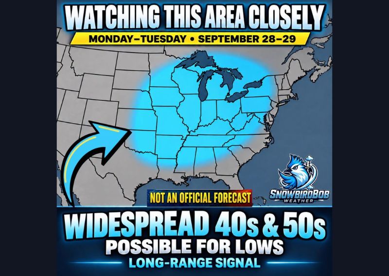
WASHINGTON, DC — Long-range weather model guidance is pointing to the possibility of a noticeably cooler air mass spreading across a large portion of the central and eastern United States around Monday and Tuesday, September 28–29. If the current pattern holds, forecasters say widespread overnight lows in the 40s and 50s could reach a broad swath of the country, stretching from portions of the Plains and Midwest through the Mid-South, the Ohio and Tennessee valleys, the Southeast, and the Mid-Atlantic region.
Extensive Geographic Coverage in Current Projections
The projected cooler air mass covers an unusually large footprint according to current long-range guidance, with the highlighted zone extending from the central Plains eastward across the Great Lakes region and southward through much of the Mid-South and Southeast. This kind of widespread coverage, if it verifies, would represent a significant early fall cool down affecting tens of millions of people across a broad and geographically diverse stretch of the country simultaneously.
Overnight Lows the Primary Focus of the Outlook
Rather than emphasizing daytime high temperatures, this outlook centers specifically on overnight low temperatures, with current guidance suggesting readings in the 40s and 50s across the highlighted region. This kind of pattern, featuring meaningfully cooler nights alongside still-warm or mild afternoons, is a hallmark of early-season transitional weather, often bringing the kind of comfortable, windows-open conditions many associate with the first genuine arrival of fall.
Long Range Signal Comes With Significant Uncertainty
Forecasters are direct in characterizing this outlook as a long-range signal rather than a confirmed forecast, explicitly noting that the strength, timing, and exact geographic coverage of the cooler air mass will likely change as the forecast period draws closer. Long-range temperature outlooks projected more than a week in advance carry substantially more uncertainty than short-term forecasts, and meteorologists caution against treating this early guidance as a locked-in outcome.
Pattern Considered Worth Continued Monitoring
Despite the uncertainty inherent in a forecast this far out, meteorologists describe the overall pattern as interesting enough to warrant close monitoring over the coming days as additional model runs become available. Should the signal continue to show consistency across subsequent forecast cycles, confidence in both the timing and the geographic extent of the cooler air mass would likely increase, giving residents across the highlighted region a clearer picture of what to expect heading into the final days of September.
For continuing coverage of severe weather events and critical storm analysis across the United States, visit diamondprowl.com.