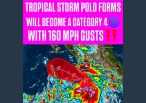
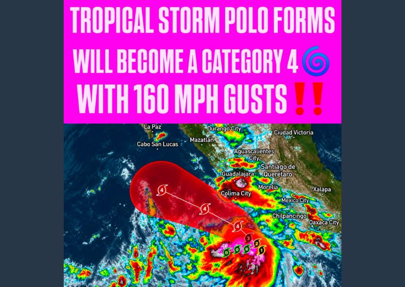
MANZANILLO, MEXICO — Tropical Depression Seventeen-E has strengthened into Tropical Storm Polo approximately 270 miles south of Manzanillo, off the southwestern coast of Mexico, with forecasters warning that the system is expected to undergo rapid intensification over the coming days. Meteorologists project Polo will strengthen into a major hurricane by the middle of the week, with some forecast models suggesting the storm could reach Category 4 strength with sustained winds and gusts approaching 160 mph at peak intensity.
Forecast Track Turns Toward the Coast
Polo is expected to turn east on Tuesday before slowing its forward speed and executing a sharp turn toward the north and northwest on Wednesday, a shift that would bring the strengthening system closer to Mexico’s southwestern coast. Forecasters caution that it remains too early to pinpoint the storm’s exact landfall location or the specific severity of potential wind and coastal impacts, emphasizing that the track remains subject to change as additional data becomes available.
Rapid Intensification Expected Over Open Water
Meteorologists are highlighting the potential for rapid intensification as one of the most significant aspects of Polo’s forecast, a process in which a tropical system’s maximum sustained winds increase dramatically over a short period, typically 24 hours or less. Current guidance suggests Polo could strengthen from a tropical storm into a major hurricane in a relatively compressed timeframe, underscoring the importance of continued close monitoring as the system moves over favorable ocean conditions.
Life Threatening Rainfall Expected Regardless of Track
Independent of Polo’s exact path, forecasters warn that dangerous rainfall is expected across coastal portions of Michoacán, Colima, and Jalisco through Thursday. Widespread rainfall totals of 4 to 8 inches are forecast, with isolated amounts potentially approaching 12 inches in the hardest-hit locations. This level of rainfall could produce life-threatening flash flooding and mudslides, particularly across mountainous terrain and areas with steep slopes vulnerable to rapid runoff.
Coastal Interests Urged to Monitor Closely
Given the uncertainty surrounding Polo’s precise track and the potential for both damaging winds and life-threatening flooding, forecasters are urging residents and interests along Mexico’s southwestern coast to closely monitor the storm’s progress in the coming days. As Polo continues its forecast intensification into a major hurricane, updated guidance on its exact path and strength will become increasingly important for communities that could fall within its eventual landfall zone.
For continuing coverage of severe weather events and critical storm analysis across the United States, visit diamondprowl.com.