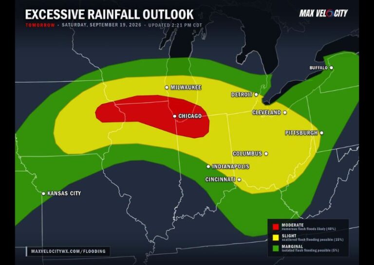
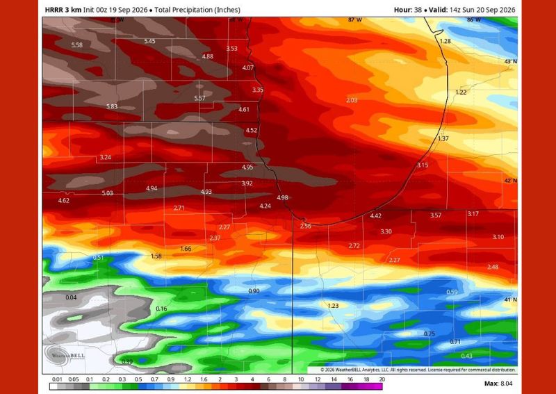
ROCKFORD, IL — A significant multi-wave rainfall event is set to unfold across Illinois and Wisconsin, with the latest model guidance shifting the heaviest rain farther south into a two-wave setup that meteorologists say has flooding potential written all over it. The first wave of torrential rain with embedded thunderstorms is expected to begin earlier than previously anticipated, moving through roughly between 6 AM and 10 AM, followed by a brief break heading into the early afternoon hours before a second, potentially longer-lasting round arrives.
Two Distinct Rounds of Heavy Rain Expected
Forecasters are highlighting a two-wave pattern for this event, with the first round of torrential rain and thunderstorms arriving in the morning hours before a temporary lull develops for the early afternoon. A second wave is then expected to move in during the late afternoon, bringing renewed heavy thunderstorms that could persist well into the overnight hours. Meteorologists note this second wave carries the potential to continue for an extended period, adding significantly to overall rainfall totals across the region.
Extreme Rainfall Totals Possible in Some Areas
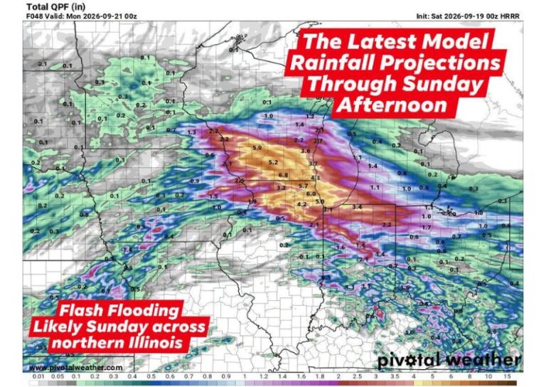
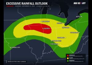
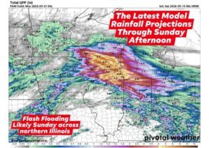
High-resolution model output shows the potential for extreme rainfall accumulations across parts of Illinois and Wisconsin, with some localized totals approaching 8 inches by Sunday afternoon. The heaviest projected totals, generally in the 4 to 6 inch range, are concentrated across a broad swath of the region, with several pockets showing potential for 5 inches or more. Totals are expected to decrease farther east, with some areas seeing considerably lighter amounts as the heaviest moisture remains focused over the primary corridor.
Atmospheric Setup Favors Significant Flooding
Meteorologists point to several contributing factors behind the flooding concern, including strong moisture advection occurring over the top of a heat dome positioned to the south, which is helping funnel unusually high levels of atmospheric moisture into the region. Record precipitable water levels for September are in place, while a stalled frontal boundary overhead is expected to provide nearly continuous lift. Combined with substantial atmospheric instability, these ingredients support the potential for deep thunderstorm cores capable of producing very heavy rainfall rates.
Not Every Location Expected to Flood
Despite the widespread heavy rainfall potential, forecasters caution that flooding impacts will not be uniform across the entire region. Some pockets of Illinois and Wisconsin may deal with hydrologic issues by Sunday night, while other nearby areas could see comparatively lighter impacts depending on exactly where the heaviest thunderstorm cores set up during both rounds. Residents throughout the affected region are advised to monitor local conditions closely as the two-wave system moves through over the coming day.
For continuing coverage of severe weather events and critical storm analysis across the United States, visit diamondprowl.com.