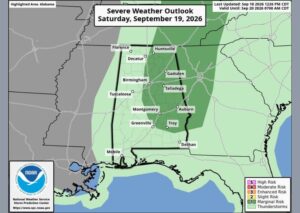
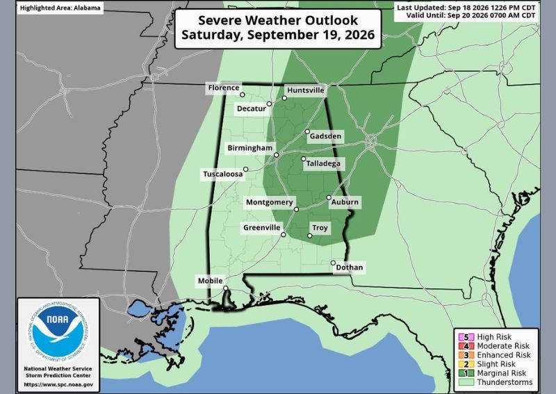
TUSCALOOSA, AL — A combination of dangerous heat and the potential for strong thunderstorms is expected to affect much of Alabama on Saturday, with temperatures forecast to approach 100 degrees during peak afternoon hours across the western half of the state. The National Weather Service Storm Prediction Center has placed roughly the eastern half of Alabama under a Marginal Risk, or Level 1 of 5, for severe thunderstorms, with the primary hazards expected to be strong wind gusts and frequent lightning.
Dangerous Heat Levels Expected Through the Afternoon
Forecasters are highlighting the heat as the most immediate concern heading into Saturday afternoon, with temperatures forecast to climb near 100 degrees by mid-afternoon across western Alabama, including the Tuscaloosa area. This level of heat poses a significant risk for anyone spending extended time outdoors during the hottest part of the day, particularly given the added humidity typical of late-September conditions across the Deep South.
Storms Expected to Be Scattered but Locally Strong
The second major weather concern for Saturday involves the potential for thunderstorm development across the region. Forecasters describe the expected storm activity as random and scattered rather than widespread, but note that wherever storms do manage to form, they are likely to be locally strong. The Storm Prediction Center’s Marginal Risk designation covers roughly the eastern half of Alabama, including areas around Huntsville, Gadsden, Talladega, and Auburn.
Strong Winds and Lightning the Primary Hazards
Meteorologists indicate that the main hazards associated with any severe thunderstorm activity Saturday will come from strong, gusty winds and frequent lightning strikes rather than large hail or tornadoes. This type of severe weather setup is common during periods of intense summer-like heat, as strong daytime heating combined with sufficient atmospheric moisture can fuel isolated but intense thunderstorm cells capable of producing damaging wind gusts in a short period of time.
Conditions to Be Monitored Closely Through the Day
Given the combination of dangerous heat and the potential for locally strong thunderstorms, forecasters plan to closely track both temperature trends and radar developments throughout the day on Saturday. Residents across Alabama, particularly those in the eastern half of the state within the Marginal Risk zone, are advised to stay weather-aware through the afternoon and evening hours as scattered storms develop and heat indices remain elevated across the region.
For continuing coverage of severe weather events and critical storm analysis across the United States, visit diamondprowl.com.