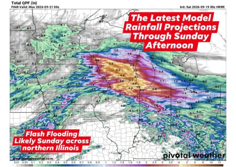
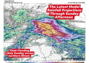
CHICAGO, IL — A dangerous flash flooding event is unfolding across the Midwest heading into the weekend, with forecasters warning that multiple rounds of slow-moving thunderstorms will begin tracking over eastern Iowa, northern Illinois, and southern Wisconsin starting early Saturday morning. Residents living in and around the Chicago and Milwaukee metro areas face the greatest concern, as repetitive storms moving over the exact same locations are expected to cause rainfall totals to accumulate rapidly throughout the day.
Atmosphere Loaded With Near Record Moisture
Forecasters note that the atmosphere across the affected region is carrying near-record levels of moisture for mid-September, setting the stage for an unusually intense rainfall event. Some individual storm cells are expected to unleash torrential rainfall rates exceeding 2 inches per hour, a rate capable of overwhelming drainage systems in a matter of minutes. This combination of extreme moisture and repetitive storm tracking is the primary factor driving the elevated flash flooding concern across the region.
Highest Threat Centers on Saturday Afternoon and Evening
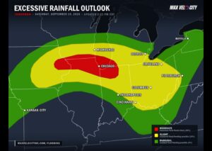
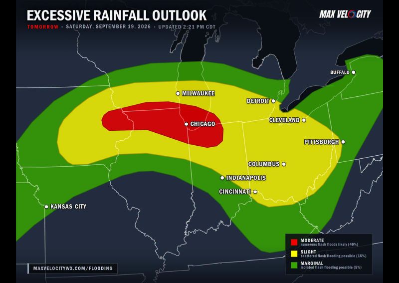
The most dangerous window for flash flooding is expected to arrive during Saturday afternoon and evening, as the intense rainfall rates overwhelm urban corridors and ground that has already become saturated from earlier rounds of rain. Chicago in particular sits within the highest-risk zone, categorized as facing numerous likely flash floods, while surrounding areas including Milwaukee fall within a slightly lower but still significant risk category for scattered flash flooding through the same period.
Moderate Risk Zone Centers on Chicago
The Excessive Rainfall Outlook places a Moderate Risk zone directly over the Chicago metro area, indicating forecasters believe numerous flash floods are likely within that corridor. A broader Slight Risk zone extends outward to include Milwaukee, Detroit, Cleveland, Columbus, Indianapolis, and Cincinnati, reflecting a somewhat lower but still meaningful chance of scattered flash flooding across those metro areas as the system tracks through the region.
System Shifts Toward the Ohio Valley Saturday Night
As the slow-moving system gradually shifts eastward Saturday night, forecasters expect the broader flash flooding risk to spread into the Ohio Valley, affecting communities from Columbus to Pittsburgh as the heavy rainfall continues to progress. While the most extreme rainfall rates are expected to diminish somewhat as the system moves east, the combination of already-wet ground and continued rounds of rain keeps a meaningful flash flooding threat in play across the broader Midwest and Ohio Valley region through the overnight hours.
For continuing coverage of severe weather events and critical storm analysis across the United States, visit diamondprowl.com.