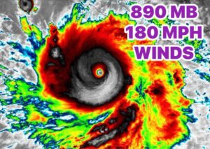


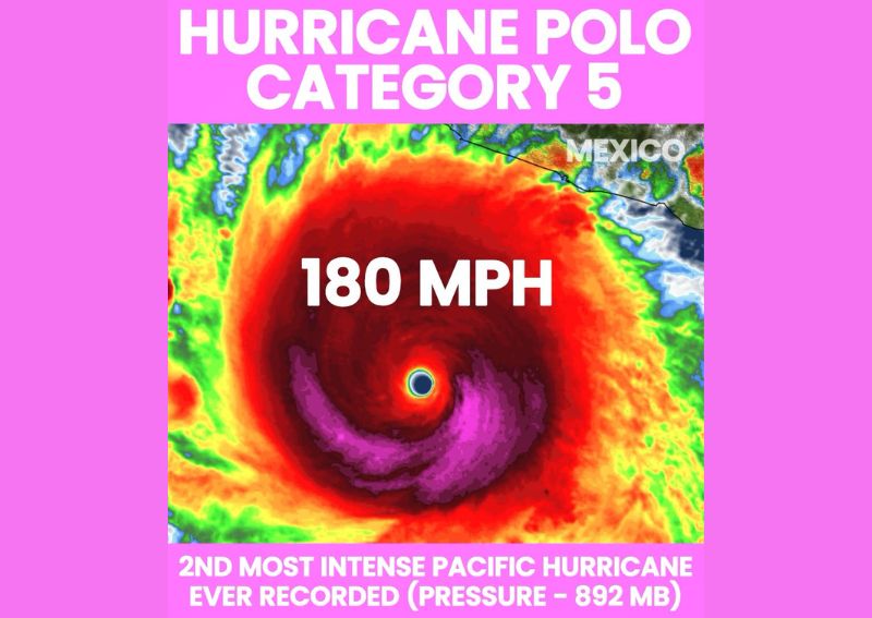
MANZANILLO, MEXICO — Hurricane Polo has explosively intensified into a Category 5 hurricane and is now recognized as the second most intense hurricane ever recorded in the Pacific basin, with its central pressure plummeting to an extremely low 892 millibars. Polo’s rapid transformation from a 45 mph tropical storm into an extremely dangerous 180 mph Category 5 hurricane occurred in just 36 hours, one of the fastest intensification rates ever documented for a tropical cyclone in the region.
A Historic Pressure Reading for the Pacific Basin
Polo’s central pressure of 892 millibars places the storm in an extraordinarily rare category of tropical cyclone intensity, ranking as the second most intense hurricane ever recorded across the entire Pacific basin based on this measurement. Meteorologists note that this pressure reading is directly comparable to Hurricane Melissa, which struck near Jamaica last year and similarly achieved an extremely low central pressure during its own period of peak intensity, underscoring just how historically significant Polo’s current strength has become.
Pressure readings this low are exceedingly uncommon, occurring in only a small handful of documented tropical cyclones throughout recorded history, making Polo’s achievement of this benchmark a significant meteorological milestone for the eastern Pacific hurricane basin specifically.
Extraordinarily Rapid Intensification Documented
The speed of Polo’s intensification stands out as equally remarkable as its ultimate strength. The storm transformed from a relatively modest 45 mph tropical storm into an extremely dangerous 180 mph Category 5 hurricane in a span of just 36 hours, a rate of strengthening that qualifies as explosive even by the standards of rapid intensification events, which typically require only a 35 mph increase within 24 hours to meet the formal definition.
This kind of extraordinarily fast strengthening often occurs when a storm encounters a combination of exceptionally warm ocean waters, low wind shear, and a moist surrounding atmosphere all at once, allowing the storm’s core to organize and intensify with minimal disruption over a very short period.
Additional Strengthening Remains Possible
Despite already reaching Category 5 intensity with 180 mph winds, forecasters caution that additional strengthening remains possible in the hours ahead as Polo continues to track over favorable oceanic conditions. Any further intensification would push the storm even closer to the theoretical upper limits of tropical cyclone intensity, making continued monitoring of Polo’s satellite presentation and any changes to its central pressure a top priority for forecasters tracking the system.
Forecast Track Remains Highly Uncertain
Despite the clarity surrounding Polo’s current intensity, its future track remains considerably less certain. Roughly two-thirds of available forecast models currently point toward the storm eventually approaching the Baja California peninsula, while the remaining third of model guidance suggests Polo could instead curve out to sea over the next week, sparing the coastline a direct encounter with the historically powerful hurricane.
This kind of significant model disagreement on track, even as the storm’s current intensity is well established, creates a genuinely tricky forecasting situation for meteorologists and emphasizes the importance of continued monitoring as Polo’s eventual path becomes clearer in the coming days. Given the storm’s extraordinary strength, any scenario bringing Polo close to the Baja California peninsula would carry serious implications for coastal communities in its path.
Meteorologists closely tracking the storm say the coming days will be critical in narrowing down which of the two competing scenarios is more likely to verify, as additional model runs incorporate updated data on the storm’s structure, surrounding steering currents, and the broader atmospheric pattern across the eastern Pacific. Until that clarity emerges, both possibilities remain on the table, and residents and officials along Mexico’s Pacific coast are being urged to stay closely tuned to updates as forecasters continue working to narrow the range of potential outcomes.
Given Polo’s historic intensity, comparisons to previous powerful Pacific hurricanes are likely to continue in the coming days as meteorologists work to place this storm’s characteristics into proper historical context. The storm’s combination of an extraordinarily low central pressure, maximum sustained winds of 180 mph, and one of the fastest intensification rates ever documented make it a significant case study regardless of its eventual track, offering researchers valuable data on the conditions capable of producing such rapid and extreme strengthening in the eastern Pacific basin.
For continuing coverage of severe weather events and critical storm analysis across the United States, visit diamondprowl.com.