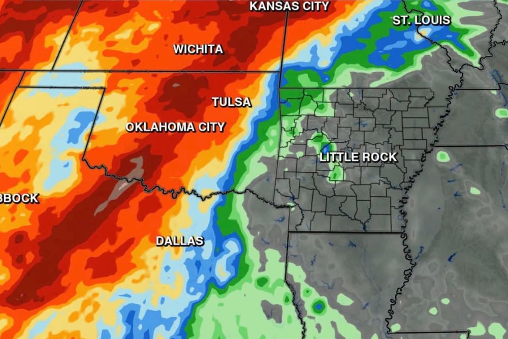
LITTLE ROCK, AR — Rain chances across Arkansas are starting to look very limited through Thursday, as a frontal boundary that had appeared poised to advance east quickly just a couple of days ago is now expected to get held up to the west for a period of time. In the meantime, warmer temperatures are set to return, with highs climbing into the upper 80s and low 90s from Tuesday through Thursday as heat and humidity get pulled north ahead of the next system.
Front Expected to Stall Before Eventually Moving East
Forecasters had previously expected a frontal boundary to sweep across the region relatively quickly, but the latest data shows this front getting held up to the west for the time being rather than advancing on the timeline previously anticipated. While a front is still expected to eventually sweep east toward the end of this week or into next weekend, meteorologists emphasize that exactly how this plays out remains highly uncertain, partially due to the influence of a hurricane currently positioned off the coast of Mexico.
This kind of stalled front pattern often develops when competing atmospheric features interact in ways that temporarily disrupt the typical progression of a frontal system, and the presence of a significant tropical system in the broader pattern adds an additional layer of complexity to forecasting exactly when and how the front will ultimately move through.
Rising Temperatures Ahead of the Next System
With rain chances limited and the front stalled to the west, temperatures across Arkansas are expected to climb noticeably over the coming days. Forecasters project highs reaching the upper 80s to low 90s from Tuesday through Thursday, as heat and humidity get drawn northward ahead of the eventual approach of the next weather system. This warming trend represents a temporary reversal of any cooler conditions residents may have experienced recently, driven by the specific atmospheric setup currently in place across the region.
Humidity Stays Low Until at Least Tuesday
Despite the anticipated rise in temperatures, forecasters note that humidity levels are expected to remain relatively low until at least Tuesday, offering a brief window of more comfortable conditions even as temperatures begin their upward trend. This combination of rising heat but still-manageable humidity provides a short transitional period before the fuller effects of the approaching warm, humid airmass take hold later in the week.
Long Range Outlook Offers a Promising Signal
Looking further ahead, forecasters point to long-range data spanning 7 to 9 days out as still looking very promising for both a genuine chance of rain and another meaningful step down in temperatures, with projections suggesting a return to the 70s and 80s. While this remains a longer-range signal subject to change as the forecast period draws closer, the consistency of this promising trend across multiple forecast cycles offers some encouragement for residents hoping for eventual relief from the current dry, warming pattern.
Rain Remains Badly Needed Across the Region
Given the persistently limited rain chances through the near term, forecasters continue to emphasize just how badly the region needs meaningful rainfall, expressing hope that the eventual arrival of the stalled front, combined with the promising long-range signal, can finally deliver much-needed precipitation at some point in the coming week to ten days. Until then, residents across Arkansas should prepare for a stretch of warm, mostly dry conditions before any potential relief arrives.
For continuing coverage of severe weather events and critical storm analysis across the United States, visit diamondprowl.com.