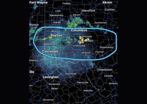

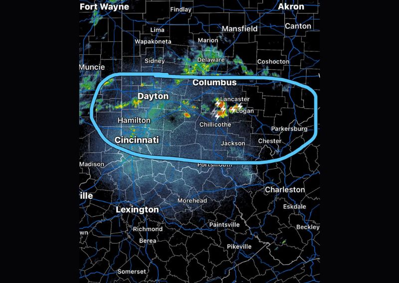
COLUMBUS, OH — A round of showers and thunderstorms is rapidly increasing across a wide stretch of southern Ohio late Friday night, with forecasters highlighting a large circled zone stretching from near Dayton and Cincinnati eastward through Columbus, Lancaster, and Chillicothe. While severe storms are not expected with this activity, locally heavy rain and lightning are likely with any storms that do develop over the next several hours as the system continues tracking through the region.
Storm Activity Concentrated South of Columbus
As of 10:15 PM, meteorologists noted that while there weren’t many downpours occurring across the immediate area at that time, a strong storm was located just south of Columbus and continuing to develop. This cell represented one of the more active features on radar, with lightning strikes visible in the vicinity of Lancaster and Logan, indicating a storm capable of producing locally intense rainfall as it continued moving through the region.
East Southeast Movement Expected
Forecasters indicated that the overall movement of the developing storm activity would be east-southeast, meaning communities positioned in that direction from the current storm locations should prepare for increasing shower and thunderstorm coverage over the following hours. This general movement pattern is consistent with typical storm motion across the Ohio Valley during this time of year, as systems tend to track along the prevailing upper-level wind flow.
Wide Area Highlighted for Increasing Activity
The circled zone on the radar image spans a substantial portion of southern Ohio, stretching from near Dayton and Hamilton in the west through Columbus and Chillicothe in the east. This broad highlighted area reflects forecasters’ expectation that showers and storms will become more numerous and organized across this entire corridor over the next few hours, rather than remaining confined to the isolated cells currently visible on radar.
No Severe Weather Expected but Caution Urged
Despite the expected increase in storm coverage, forecasters do not anticipate severe thunderstorms developing with this particular round of activity. However, residents across the highlighted zone are advised that any storms that do fire could produce locally heavy rainfall and frequent lightning strikes, both of which can create hazardous conditions for anyone caught outdoors or driving through affected areas during the overnight hours.
For continuing coverage of severe weather events and critical storm analysis across the United States, visit diamondprowl.com.