
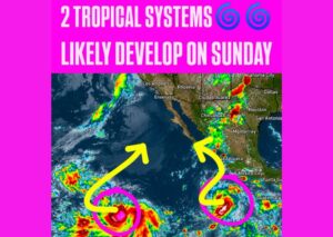
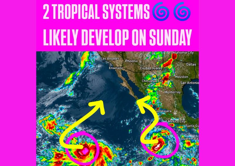
EASTERN PACIFIC — Forecasters are tracking two separate areas of low pressure in the eastern Pacific, both of which are given a 90 percent chance of developing into tropical systems by Sunday. The two disturbances are positioned close enough to one another that meteorologists say their proximity could produce unusual or “wonky” motion, with each system potentially influencing the track of the other as they continue to organize over the coming days across the open eastern Pacific waters.
Both Systems Carry High Development Odds
Both areas of low pressure currently under observation carry a 90 percent chance of tropical development, an unusually high probability that reflects favorable conditions for organization across this stretch of the eastern Pacific. Satellite imagery shows each disturbance already displaying signs of increasing organization, with rotating cloud patterns visible around both systems as they track across warm ocean waters south of Mexico and the Baja California peninsula.
Proximity Could Create Unusual Storm Motion
Meteorologists are specifically flagging the potential for wonky motion between the two systems given how close they are positioned to one another. When two tropical disturbances develop in relatively close proximity, their circulations can interact in a phenomenon that sometimes causes one or both systems to take an unusual or less predictable track compared to how a lone system might typically behave under the same broader atmospheric pattern.
Moisture Expected to Stream Into Mexico and the US
Regardless of how the two systems ultimately track, forecasters expect tropical moisture associated with the developing disturbances to stream northward into portions of Mexico and parts of the United States over the coming 7 to 10 days. This moisture influx could bring periods of increased shower and thunderstorm activity to areas along the path of the moisture plume, including portions of the Desert Southwest and the southern Plains.
Continued Monitoring Through the Weekend
With both systems carrying such high development odds, meteorologists plan to closely track their progress heading into Sunday as they continue to organize across the eastern Pacific. The potential for interaction between the two systems adds an additional layer of complexity to the forecast, and updated guidance on their eventual tracks and intensities is expected to become clearer as both areas of low pressure continue developing over the next several days.
For continuing coverage of severe weather events and critical storm analysis across the United States, visit diamondprowl.com.